It is clear from the accounts of those who travelled up the Manawatu River towards the Gorge during the 1840s and 1850s that much of the land for several kilometres on either side of the river was covered in dense forest. Podocarps, especially totara, were often dominant on the river flats and would have been most obvious to the early travellers. The continuous nature of the forest, broken only by the river and by occasional clearings, is apparent from maps based on the survey of the region carried out by J. T. Stewart in 1858-9 to fix the boundaries of the Ahuaturanga block. Stewart's map (S.O. 10603) indicates the importance of totara and matai on the land near the present-day Linton Military Camp, and of totara further to the northeast on the flat land near the site of the Aokautere School. "Fine totara timber" is also marked near the Papaioea clearing in the area now occupied by the northern part of the city of Palmerston North.
A valuable account of the changes that have occurred during the 130 years since Stewart's journeys has been given by A. E. Esler ("Botany of the Manawatu District, New Zealand", DSIR Information Series No. 127, 1978). Esler observed that not a vestige of the totara forest remains as it was a century ago. Even before they were seen by Europeans, the totara stands may have suffered from changes in levels of the Manawatu River, and from Maori fires. With the rapid development of European settlement at Palmerston North from 1871 and on the eastern side of the river in the late 1870s and 1880s, the great stands of totara, matai, rimu, kahikatea and other millable timber were rapidly exploited. G. C. Petersen records that 23 sawmills were operating or were being built in the Upper Manawatu in 1879.
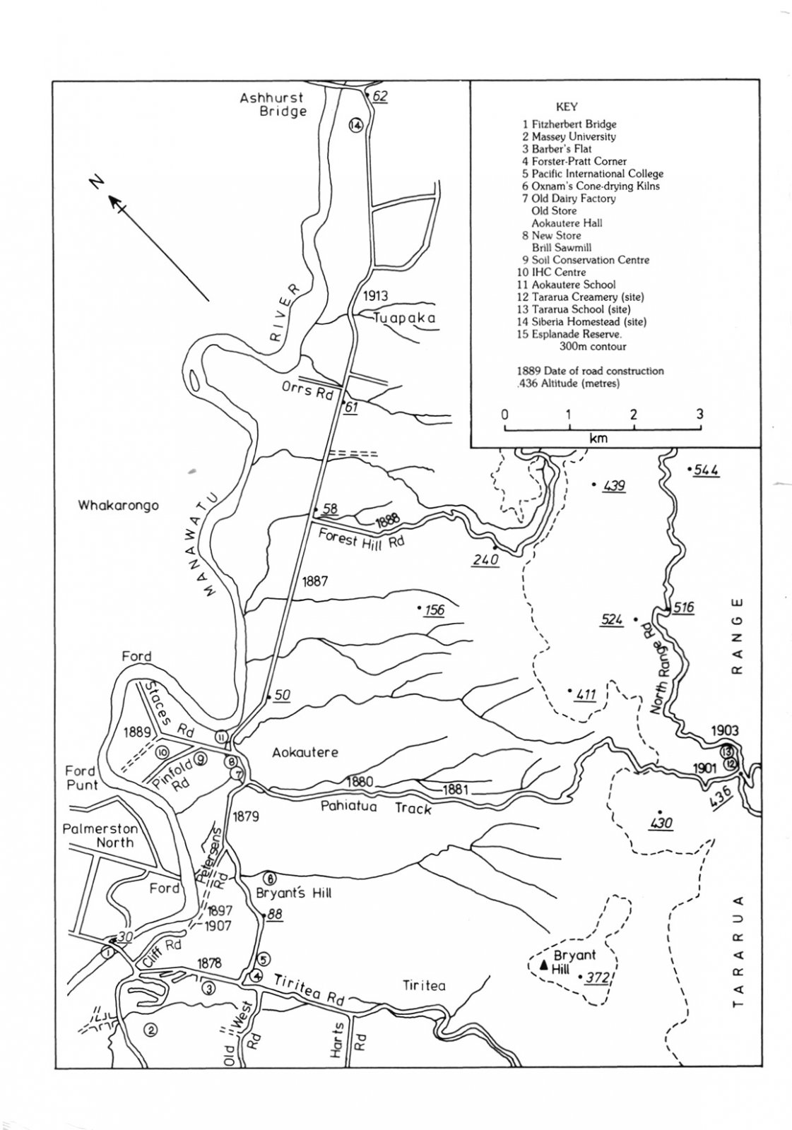
Above the river flats on the east side of the river between Scotts Road and the Pahiatua Track, totara was less prominent. The terraces were mainly occupied by a mixed podocarp-broadleaf forest that often contained kahikatea, totara and pukatea, and always contained tawa. A degraded remnant of this forest, about a kilometre from the foot of the Pahiatua Track, on the south side of the road, was studied in detail by Esler, who noted that tawa is now the most conspicuous tree, but the stand also contains rimu, kahikatea, matai, miro, totara, pukatea, hinau, black maire and titoki. Further to the northeast, on the terrace country near Te Taupiri stream, are remnants of a substantial area of beech forest, which was rare in the Manawatu region. Esler estimated that beech (mainly black beech) originally covered 526 hectares on either side of Forest Hill Road, at altitudes of 90-275 metres. A few hard beech trees, and hybrids with black beech, were also noted in the remnants.
The areas occupied by black beech forests have given rise to particularly infertile and strongly leached soils, on which stands of manuka developed. According to Esler, the soils adjoining Forest Hill Road provide a good example of the fact that the richest floras are not found on the richest soils. "Because the poor soils of the Aokautere district do not readily support good pasture, many weedy species and native plants gain a foothold. The reversion to manuka is rapid unless pastures are well managed". He describes in detail the stages in the succession from degraded pasture to young manuka scrubland to mature manuka with shade-tolerant plants under the canopy. In many places, particularly on the steeper slopes, both manuka and gorse persist today as notable features of the vegetation.
In recent years the vegetation of the Aokautere district has undergone a remarkable diversification. The deeper soils of the lowest terrace have become extensively used for cropping, market gardening, and a variety of other forms of horticulture: berry fruit and flower production, tree and shrub nurseries, and orchards. In addition, the Aokautere Science Centre has been responsible for research and development in the field of plant materials for the control of soil erosion.
On steeper slopes above the terraces, there have been extensive plantings of pines and other exotics during the last twenty years. The exploitation of these plantations in the future may see sawmilling in the Manawatu at least partly regaining the importance it had a century ago.
In recent years there has been an increasing awareness of the value of preserving the small remnants of the original native forest, and several landowners have taken steps to allow regeneration to occur in these areas, free from the damage caused by browsing stock. Just beyond the extremities of the Aokautere district, in the Tiritea catchment to the south and near the Manawatu Gorge in the north, larger areas of the Tawa- dominated forest can still be seen. Tiritea reserve is the best preserved of any kind in the Manawatu. The face of the land around Aokautere, however, has been completely changed in little more than a century, and it is now necessary to travel much further afield to find large areas of totara and other podocarp forests like those described by Stewart in his first mapping of the area.